When Lewis and Clark came back to the Clearwater in May 1806, the Bitterroot Mountains were still covered in snow, and the men were anxious to get home. For nearly a month, from May 14 until June 10, the Corps camped near present-day Kamiah, at a place later known as Camp Chopunnish or Long Camp. The captains did not give the camp either name; to the men of the expedition, it was simply a temporary home along the Clearwater.
The spring season gave the explorers another opportunity to live among the Nez Perce. Salmon were beginning to run, roots were being gathered, and plants and animals were coming to life. The expedition had sixty-five horses and was gathering food and supplies for the journey east. Men traded with nearby Nez Perce villages, went fishing and collected roots. Lewis recorded Nez Perce methods of building shelters, preparing food and managing horses, learned their names for rivers east of the mountains, and noted the value of blue trade beads throughout the region.
There was also time for conversation and friendship. Lewis attempted to explain the intentions of the United States government, including its interest in trade and establishing peaceful relations with Native nations. Communication required several languages, and at one point the explorers drew a map on a mat with a piece of coal to help explain their journey. Nez Perce men visited the camp, joined the explorers in games and horse races, and continued discussing arrangements for guides. When the expedition needed meat, the Nez Perce headman Hohots Ilppilp even offered the men permission to kill one of his horses. Lewis was struck by the generosity of the gesture.
By June, the men were increasingly eager to move. The Clearwater had fallen six feet in only a few days, and Lewis believed this was evidence that much of the mountain snow was beginning to disappear. On June 9, he wrote that the men “seem much elated with the idea of moving on towards their friends and country.” They had everything ready, even though they had eaten the last of their meat and were subsisting on roots. Instead of worrying about what lay ahead, they spent the day running footraces, pitching quoits and playing prisoner’s base.
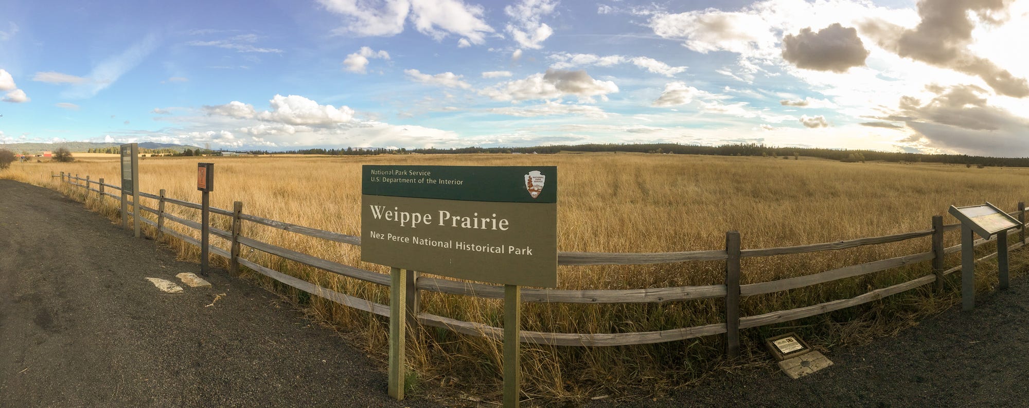
On June 10, the Corps climbed out of the Clearwater Canyon and reached Weippe Prairie, where they had first encountered the Nez Perce the previous September. The prairie was now covered in camas flowers. Lewis was struck by the blue blossoms, which from a distance looked so much like water that he described them as “lakes of fine, clear water.” The camas root was an important Nez Perce food, and Lewis carefully recorded the plant and the ways it was cultivated and prepared.
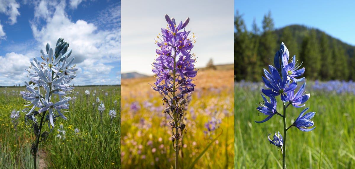
Left: Weippe Prairie, 7 June, elevation 3015 ft.
Center: Catherine Creek below The Dalles, 28 April, elevation 200 ft.
Right: Packer Meadow at Lolo Pass, 1 July, elevation 5233 ft.
The men were ready to cross the mountains, but they had misjudged the conditions. The lower country was beginning to look like summer while the high country remained buried in snow. Lewis knew that several days of their route lay across high elevations where snow could persist, and he was increasingly concerned about finding enough food for the horses. Nevertheless, the Corps headed toward the Bitterroots.
They soon discovered that the route was still blocked by snow. The crossing was too difficult for the men and horses, and the expedition had to turn back. The men had crossed the Bitterroots once, but knowing the route did not make the mountains any more cooperative. Their eagerness to reach home had run up against a landscape that still operated on its own timetable.
That experience also underscored how much the expedition had come to depend on the knowledge of the Nez Perce. The Nimiipuu understood the country through its seasons, rivers, plants, animals and mountain passes. Lewis and Clark could record what they saw, but the Nez Perce already knew how all of those pieces fit together.
Once conditions allowed, the Corps would make its way east and begin the long final journey toward home. Their time with the Nez Perce had lasted far longer than a single encounter in the fall of 1805. It had developed into a relationship based on trade, assistance, shared knowledge and, at least for a time, genuine friendship.
The story did not end when Lewis and Clark crossed the Bitterroots. Over the next seventy years, the relationship between the Nimiipuu and the expanding United States would change dramatically. Treaties would reduce the Nez Perce homeland, settlers would arrive in increasing numbers, and pressure would grow on those who refused to leave their ancestral lands.
In 1877, the same country that had helped sustain the Nez Perce and provided the route for Lewis and Clark would become the setting for a very different journey. The Nez Perce would travel more than a thousand miles trying to escape the U.S. Army and reach safety in Canada.
That is where the story takes us next.
Next Week: The Flight of 1877
More than seventy years after Lewis and Clark crossed the Bitterroots, the Nez Perce would travel many of the same landscapes under dramatically different circumstances. Their 1,300-mile flight across Idaho, Wyoming and Montana is a story of survival, conflict and extraordinary endurance. In the final installment of this series, we will follow that journey and explore how travelers today can experience the story along the Nez Perce National Historic Trail.
Planning your trip
Weippe Prairie and Discovery Center - It was at Weippe Prairie that the Lewis and Clark Expedition first met the Nez Perce people, starting a friendship critical to the success of the Expedition. The Weippe Discovery Center and living landscape tell this incredible story at the actual place where it happened.
Inside you will see Nez Perce artifacts depicting their life in the region, replicas of tools used by the Expedition, and life-size representations of Idaho’s wildlife. Inside and out, you will see numerous interpretive paintings and murals of the area’s history. Growing outside are many of the plant varieties collected and described by Meriwether Lewis. Small signs help you to learn their names and recognize them along the Clearwater and Lolo portions of the Historic Lewis and Clark Trail.
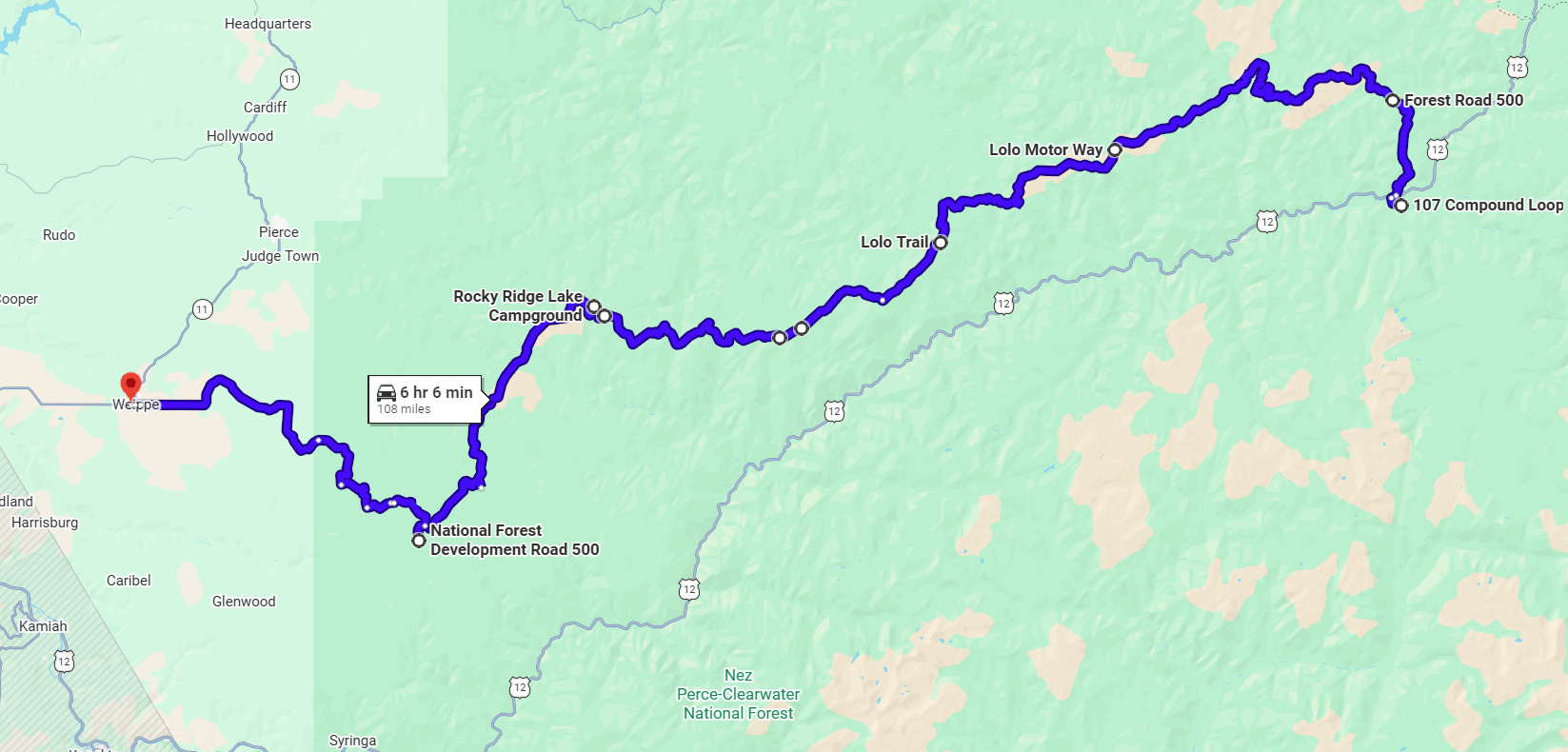
Rocky Ridge Lake is a scenic mountain lake with room for a handful of campers. Due to its scenery and relatively easy access from the west, it is not unusual to see RV’s here. (Driving RV’s on the Lolo Motorway is officially discouraged.) There is a restroom, and each site has a fire-pit and picnic table. Past the road to the lake is a viewpoint of the lake. If you take the 3-minute walk from the Lolo Motorway, you won’t be disappointed!
Weitas Meadows in 1877 was the scene of the fleeing Nez Perce and the August 2 campsite of the pursuing U.S. Army. Today, Weitas Meadow is a beautiful mountain meadow, small camping area, and a trailhead for Trail 40—the Nee-Me-Poo Trail. A well-maintained boardwalk meanders on one side of the meadow before climbing up to Green Saddle.
Sherman Peak—also known as Spirit Revival Ridge. On September 18, 1805, Meriwether Lewis wrote:
“the ridge terminated and we to our inexpressable joy discovered a large tract of Prairie . . . . the appearance of this country, our only hope for subsistance greately revived the sperits of the party already reduced and much weakened for the want of food.”
Today, a 1-mile-long trail climbs 700 feet from the Lolo Motorway to the summit of Sherman Peak. Other locations may have provided the Expedition’s viewpoint, and views of Camas Prairie can be spotty due to trees that may not have been there in 1805. Never-the-less, this hike remains popular with Lewis and Clark Trail enthusiasts. The trail begins near 46.4207, -115.3132.
Smoking Place - Smoking Place is a sacred Nez Perce site, a Lewis and Clark campsite, a more recent hunting camp, and a fire lookout site. At the trailhead is an interpretive panel and a small parking area. Smoking Place is a short ¼-mile uphill from the Lolo Motorway and offers amazing views of the Bitterroot Mountains and ceremonial rock cairns. In late-June 1806, it was here that:
“we halted by the request of the [Nez Perce] Guides a fiew minits on an ellevated point and Smoked a pipe on this eminance the nativs have raised a conic mound of Stons of 6 or 8 feet high and erected a pine pole of 15 feet long. from this place we had an extencive view of these Stupendeous Mountains principally Covered with Snow like that on which we Stood;”
—Meriwether Lewis
Indian Post Office - an iconic stopping place on the Lolo Motorway at 46.5460, -114.9877. Indian Post Office has an exceptional 360º view of the Bitterroot Mountains. Considered a sacred Native American site by many, you will also find ceremonial rock cairns and other ceremonial objects. A primitive trail leads down to two lakes, and a restored section of the Nee-Me-Poo trail has a trailhead here. There is also a sign describing the Expedition’s “Lonesome Cove” camp which is directly below.
13 Mile Camp - the Expedition’s 13-Mile Camp is worth a visit. The 1/3-mile-long trail is signed and follows the original Lolo Trail to a south-facing hillside with few trees and plenty of beargrass. (Horses don’t eat beargrass.) The campsite is in a small saddle at the top of the hill. The hill has spectacular views of the Bitterroot snow peaks and is often awash in white beargrass blooms.
Powell - At Powell, the Lewis and Clark Expedition camped on a small island in the Lochsa River. The island can be viewed at the historic Ranger Station. Lochsa Lodge has a restaurant, gas, and a small grocery, and Powell Campground has RV & tent sites, most with electricity. Parachute Hill Road intersects the Motorway to return to Highway 12 at Powell
More Resources
Lewis and Clark Trail News - our bi-weekly newsletter with Trail Happenings
Lewis and Clark Mobile App - take the Trail with you on your mobile device
Lewis & Clark Trail Alliance - learn about the work of the Alliance
Events along the Trail - our calendar of events you may wish to attend
Join The Alliance - Get involved
Additional Resources: Experience Lewis and Clark
We are grateful for the generous support of our corporate and travel partners whose sponsorship helps make this work possible. When planning your travels along the Lewis and Clark Trail, we encourage you to support the businesses and organizations that invest in preserving and sharing these stories—your patronage helps sustain both the trail and the experiences that bring its history to life.